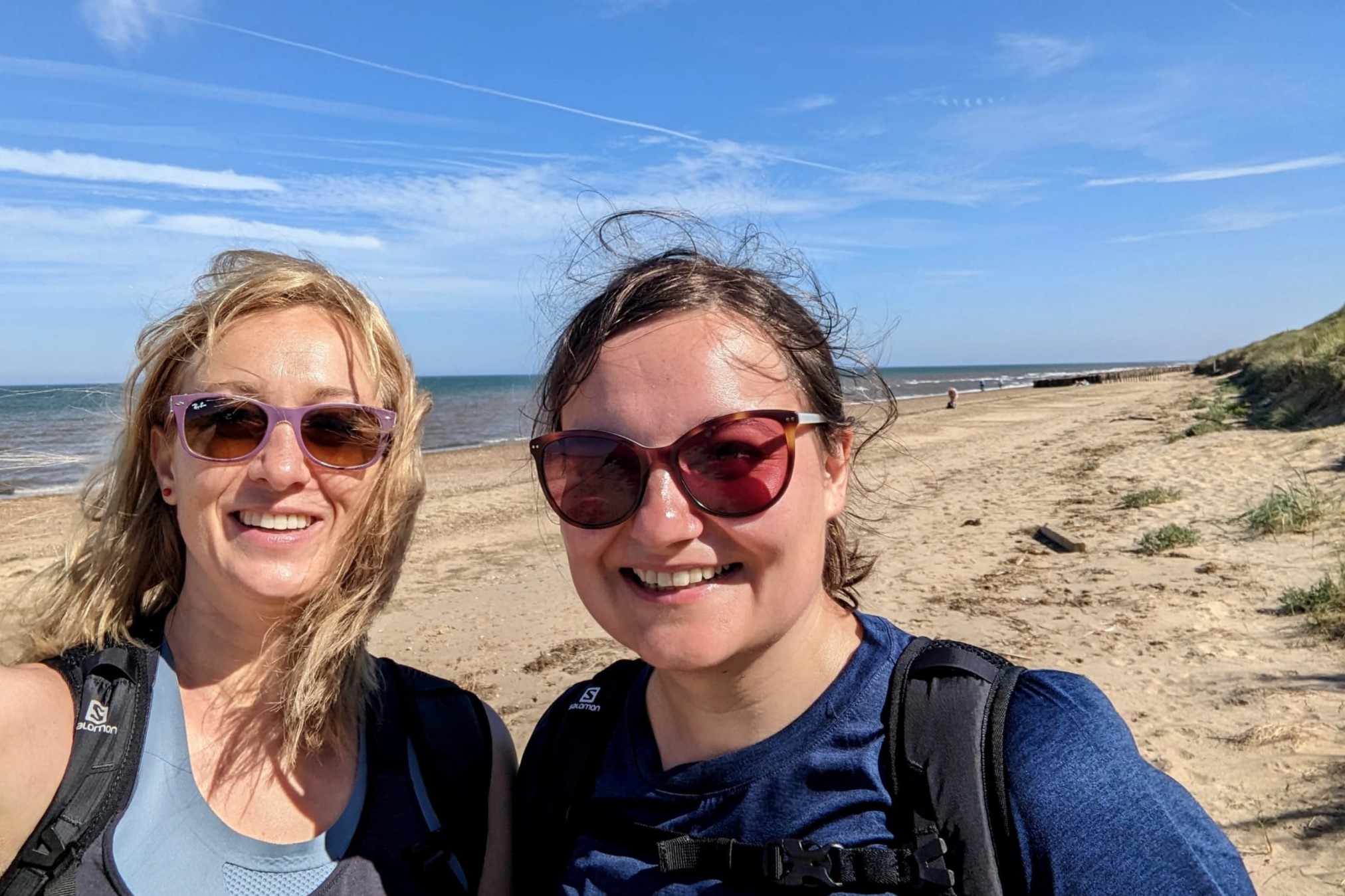
Monika and Aggie Explore the Norfolk Coast Path
I recently walked part of the Peddars Way and Norfolk Coast Path with my sister Aggie.
It’s becoming a bit of a theme to do a coastal walk every time we get a chance to go on a Fam Trip, as I’ve previously done part of the Pembrokeshire Coast Path in Wales and the Fife Coastal Path in Scotland. I’ve never been to Norfolk before, so I thought why not explore a new area.
We decided to walk the coastal section from Hunstanton to Cromer preceded with a day walking from Great Massingham to Hunstanton, just so we could get a taster of the Peddars Way.
Day 1: Great Massingham to Hunstanton
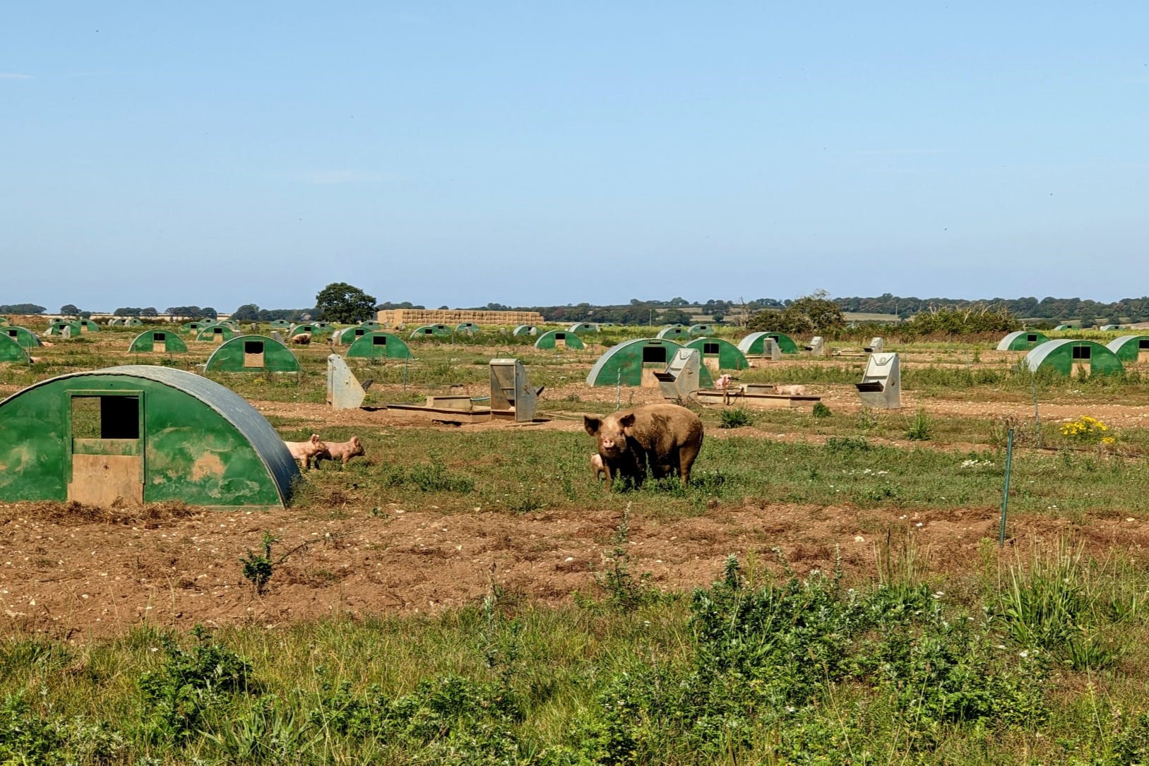
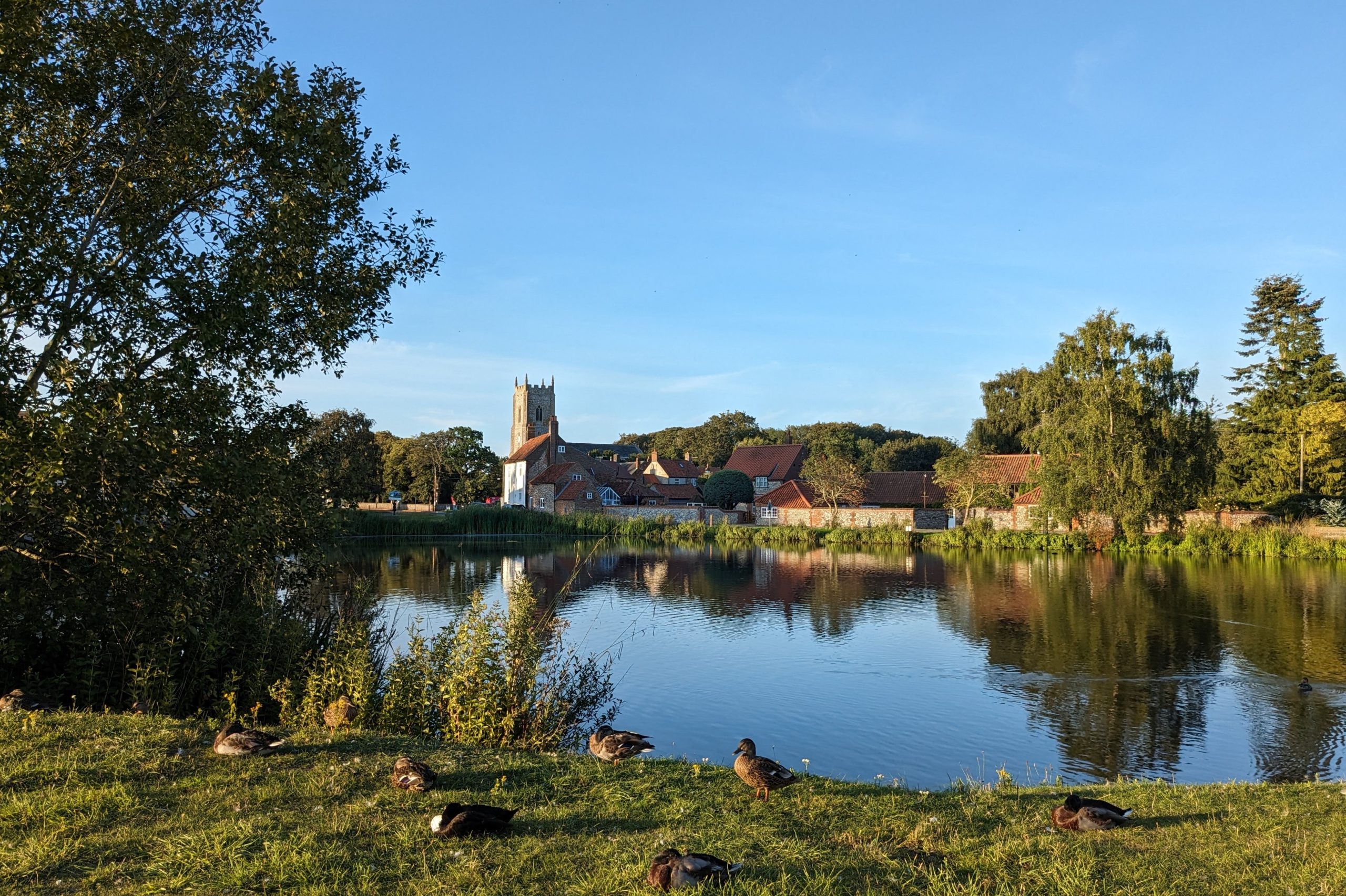
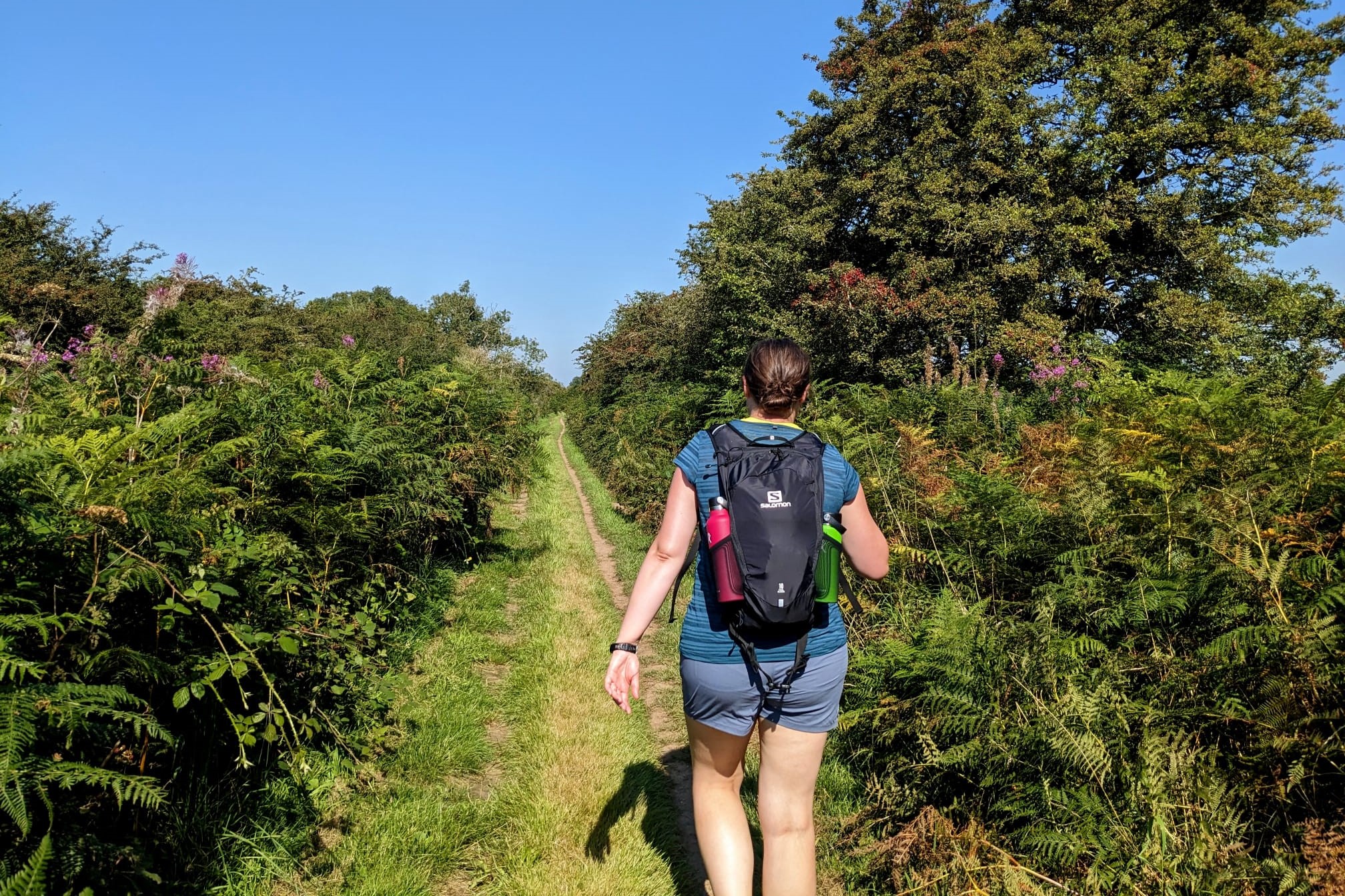
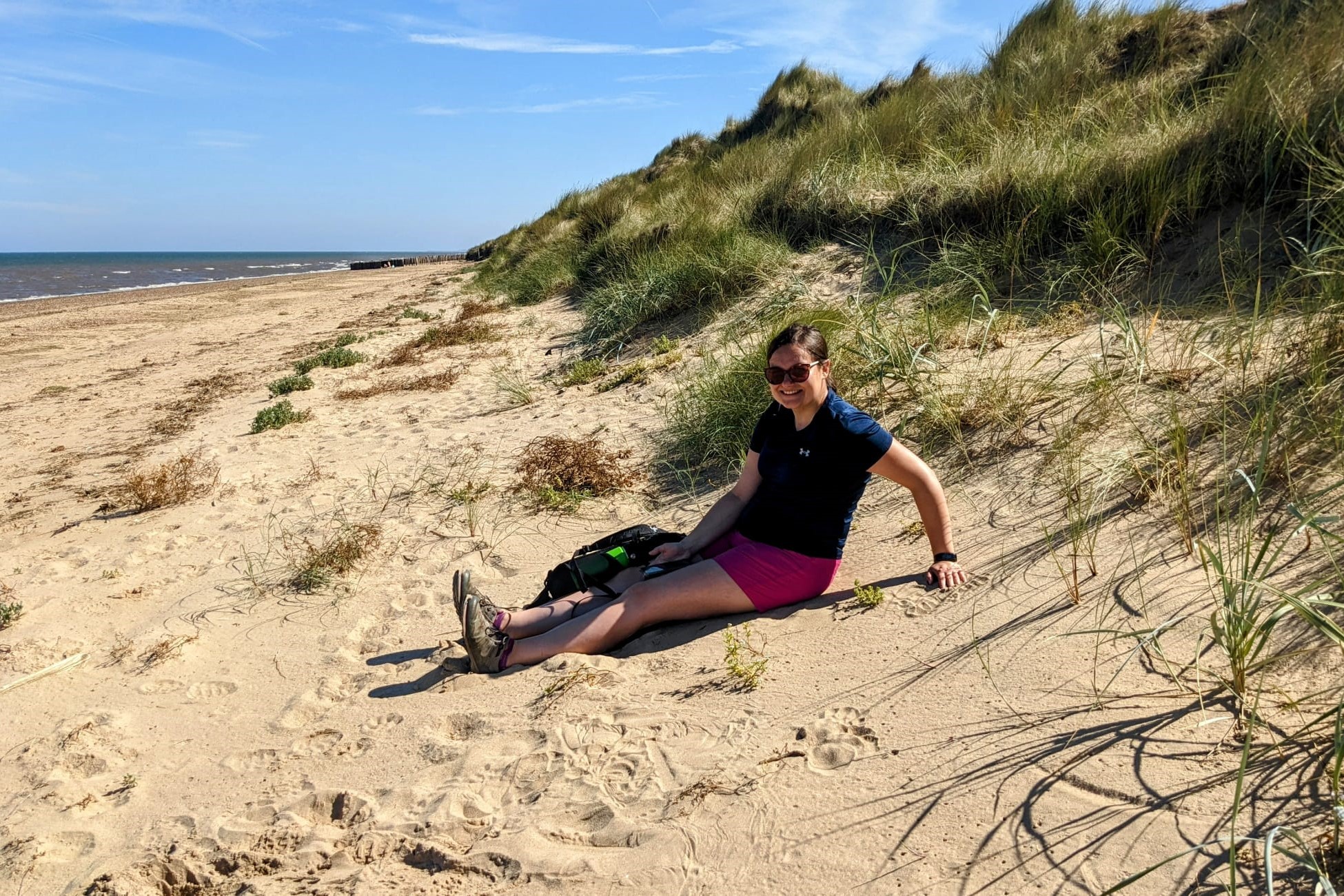
Today was going to be the longest day of our trip at just over 17 miles. After a hearty breakfast we set off from our accommodation in the pretty village of Great Massingham, which is located about a mile from the trail. Soon we were on the straight, grassy track along an old Roman Road, which occasionally just crossed quiet B roads. The track passed many pig farms and was lined either side with bushes full of blackberries, sloes, rosehips, sea buckthorns and loads more. Today’s walk was pretty much a straight line all the way to the coast, apart from the last section from Holme-Next-the-Sea.
The sun was shining all day and it happened to be one of the hottest days this year. We walked in almost 30 degrees heat with just the occasional breeze not lasting more than few seconds. Definitely not your usual British weather!
The first day did not disappoint, we’ve seen plenty of wildlife and the whole scenery brought back great memories of our childhood. We were reminiscing of all the summer holidays we’ve spent at my grandma’s house, as this section of the path although so far away from my nana’s village in Poland somehow looked just like the place we loved and cherished so much.
Day 2: Hunstanton to Brancaster
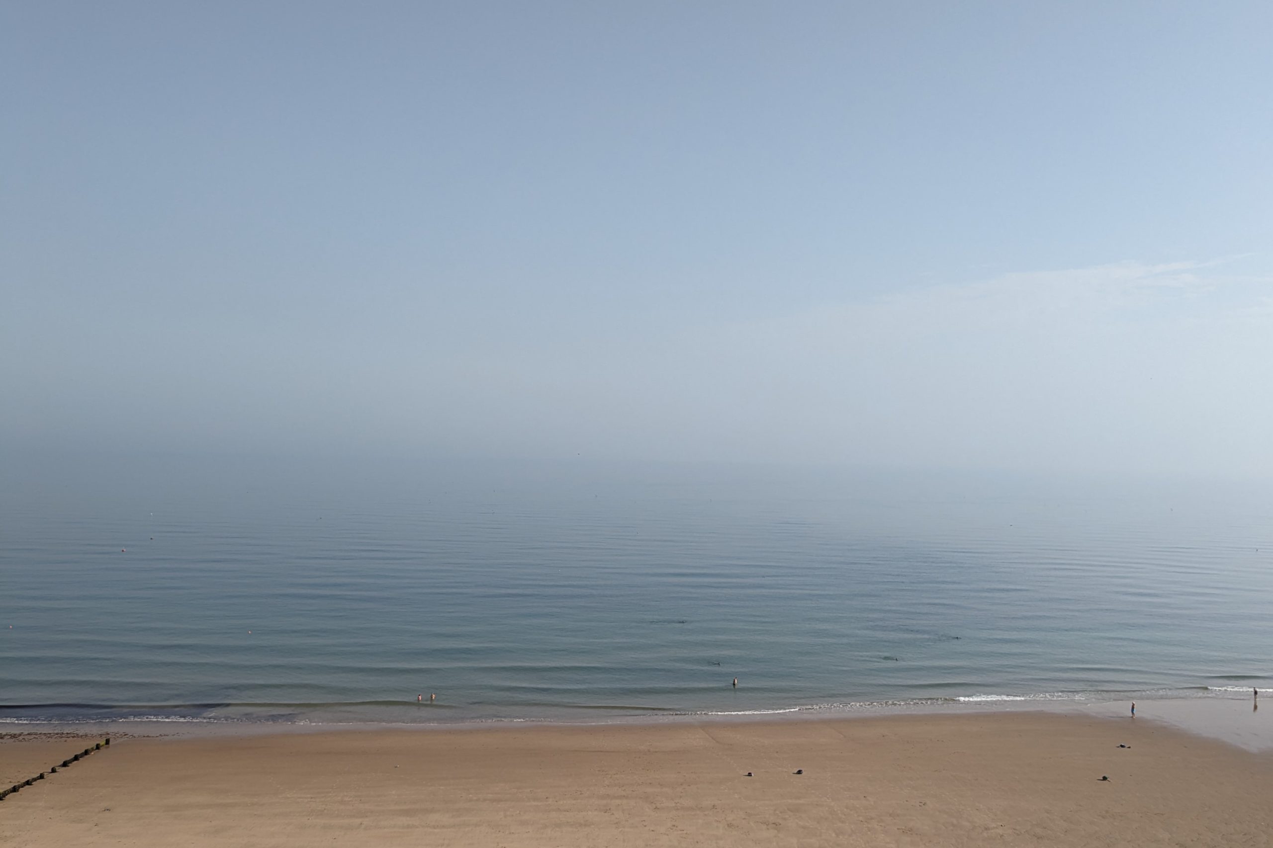
Having spent the night in Old Hunstanton, we decided to walk to Hunstanton to see the official start of the Norfolk Coast Path, adding about three miles in total to our walk, which otherwise would have been quite a short day of nine miles. Hunstanton is a popular holiday destination, well known for its red and white striped cliffs and long sandy beaches. It is here that we saw the only seal of this trip, as unfortunately we didn’t manage to get on one of the boat trips to Blakeney Point, but more on this later.
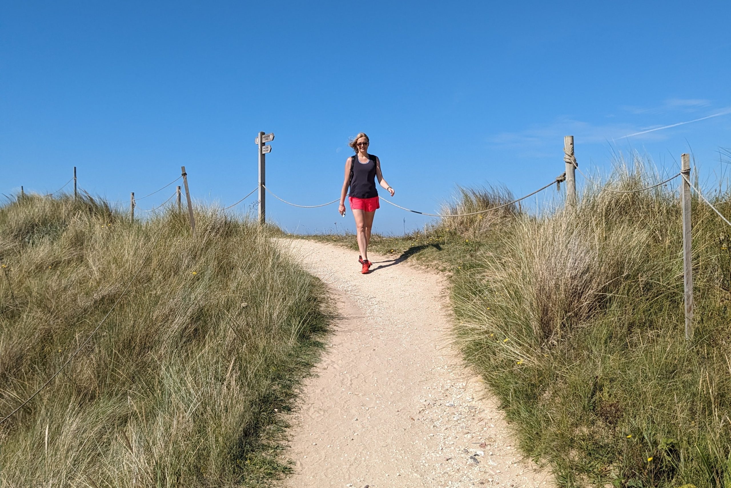
From Hunstanton you get a choice of either a lower route underneath the striped cliffs or on top of them. We decided to take the higher option along the cliff tops past the Old Lighthouse, getting amazing views of the sea. We followed the path all the way to Holme-Next-the-Sea, where the Norfolk Coast Path meets the Peddars Way. Soon we were following the well-trodden path on top of the dunes, which in places is a boardwalk, all the way to Thornham, where we stopped in a lovely coffee shop for the first slice of cake of our holiday.
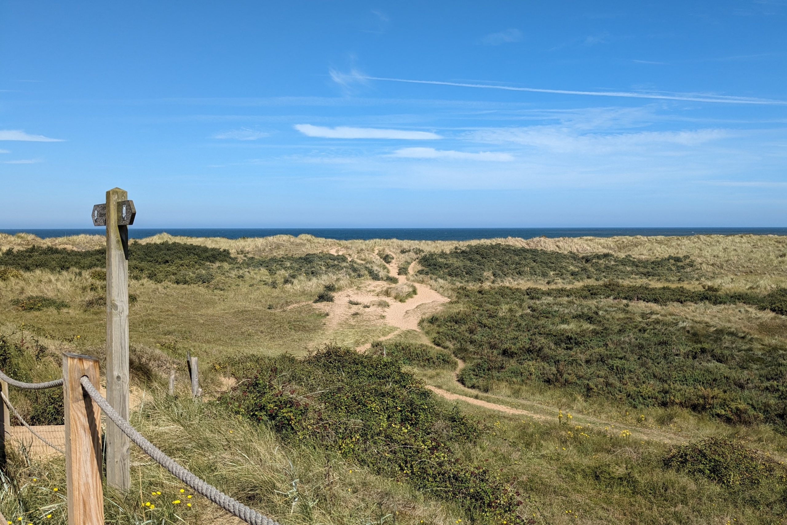
The area between Holme-Next-the-Sea and Thornham is very popular with bird watchers, as you can normally spot of variety of species including waders, curlews, herons and more. We saw a few people with their binoculars here. As there is no coastal path between Thornham and Brancaster, we had to head inland taking a path along open countryside all the way to pretty village of Brancaster, our home for the night.
Day 3: Brancaster to Wells-Next-the-Sea
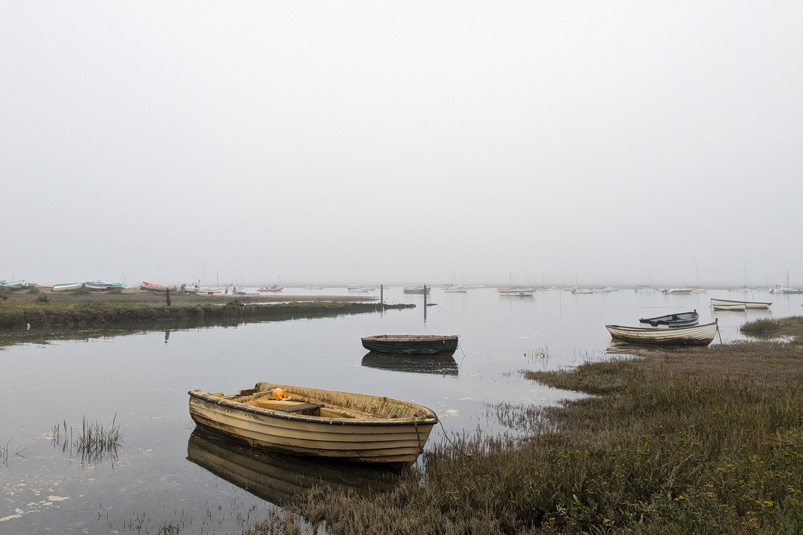
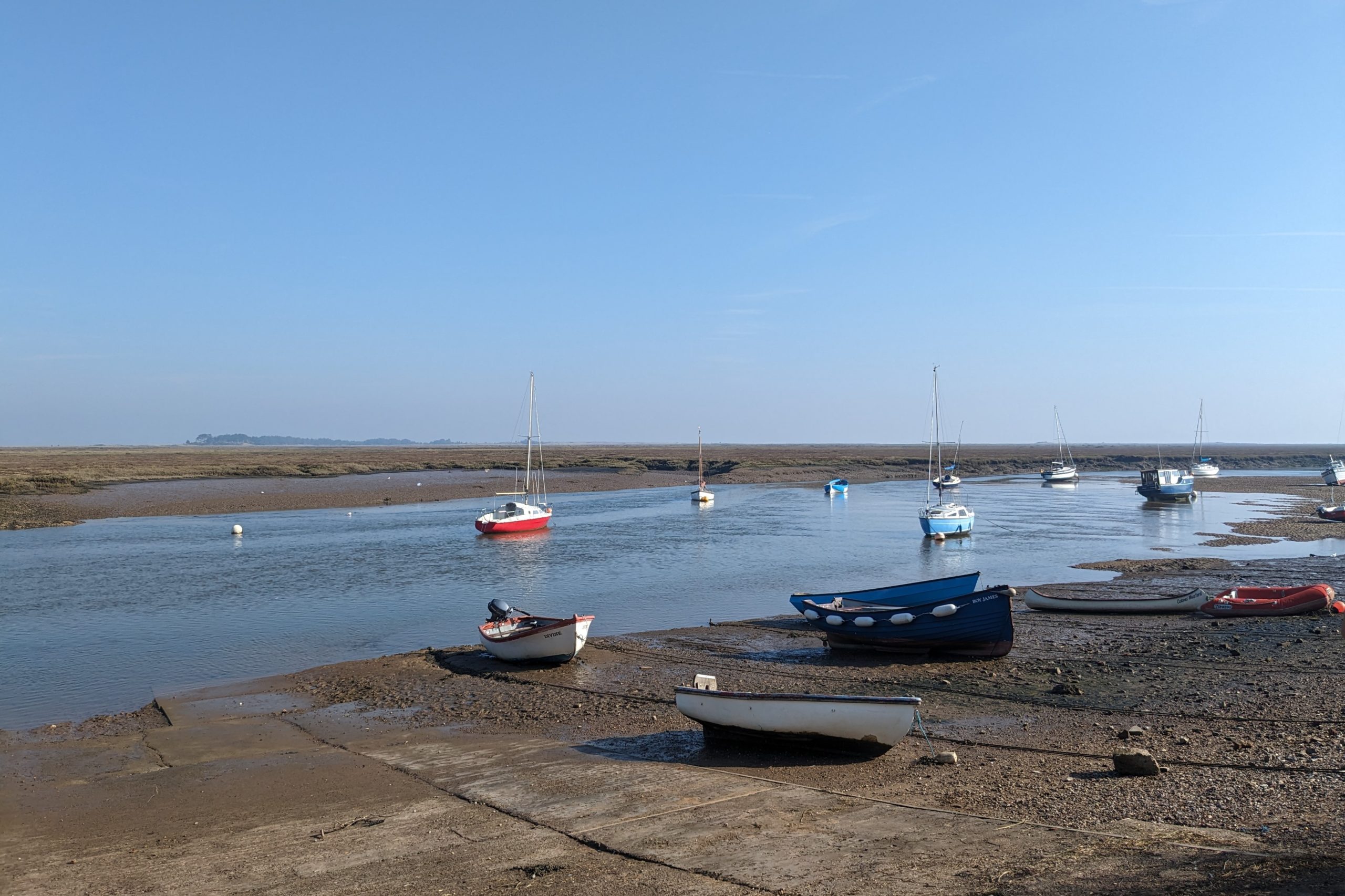
Although the forecast for the week was sunshine and blue skies, we woke up this morning to a thick fog. Hopeful that it wouldn’t last very long, we set off on our walk to Wells-Next-the-Sea. As the boardwalk at Brancaster is currently closed due to damage and is in need of full replacement, we walked the first mile and a half from Brancaster on a path alongside the A149 road before joining the coastal path at Brancaster Staithe. Brancaster Staithe is still a working fishing village, its harbour full of lobster pots, fishing nets and fishing boats. We then continued along the edge of marshes, past Burnham Deepdale all the way to the picturesque village of Burnham Overy Staithe.
Soon after leaving the village, the path enters Holkham Beach, one of the prettiest beaches in England with its wide open area and white sand. We walked down the beach all the way down to Holkham Gap, where we stopped for some refreshments before continuing down a woodland path into Wells-Next-the-Sea. The weather cleared and the fog finally lifted just as we were approaching Wells-Next-the-Sea where we were stopping for the night.
Day 4: Wells-Next-the-Sea to Cley-Next-the-Sea
After a delicious breakfast consisting of homemade pancakes with fruit, we set off through town, down to the harbour to start today’s walk. This section of the path felt somewhat different, as although we were walking the coastal path, we were nowhere near the sea for most of the day. As soon as we left Wells-Next-the-Sea we were back onto the sea defenses with mud flats on our left hand sight and fields to the right. Similar scenery continued all the way to Morston Quay where we stopped for a well-deserved break. The views up the creek are wonderful and there are a few benches to sit down and admire the landscape, which is exactly what we did.
Morston Quay is one of the places from which you can catch a boat to Blakeney Point, home to England’s largest grey seal colony. I wish we planned our day a bit better, as when we got there we were too late to get tickets for the last crossing of the day. Having had our sandwiches, we set off towards the picturesque coastal village of Blakeney. The next couple of miles were very similar to our earlier walk today, yet again on sea defences skirting round creeks until we reached the village of Blakeney.
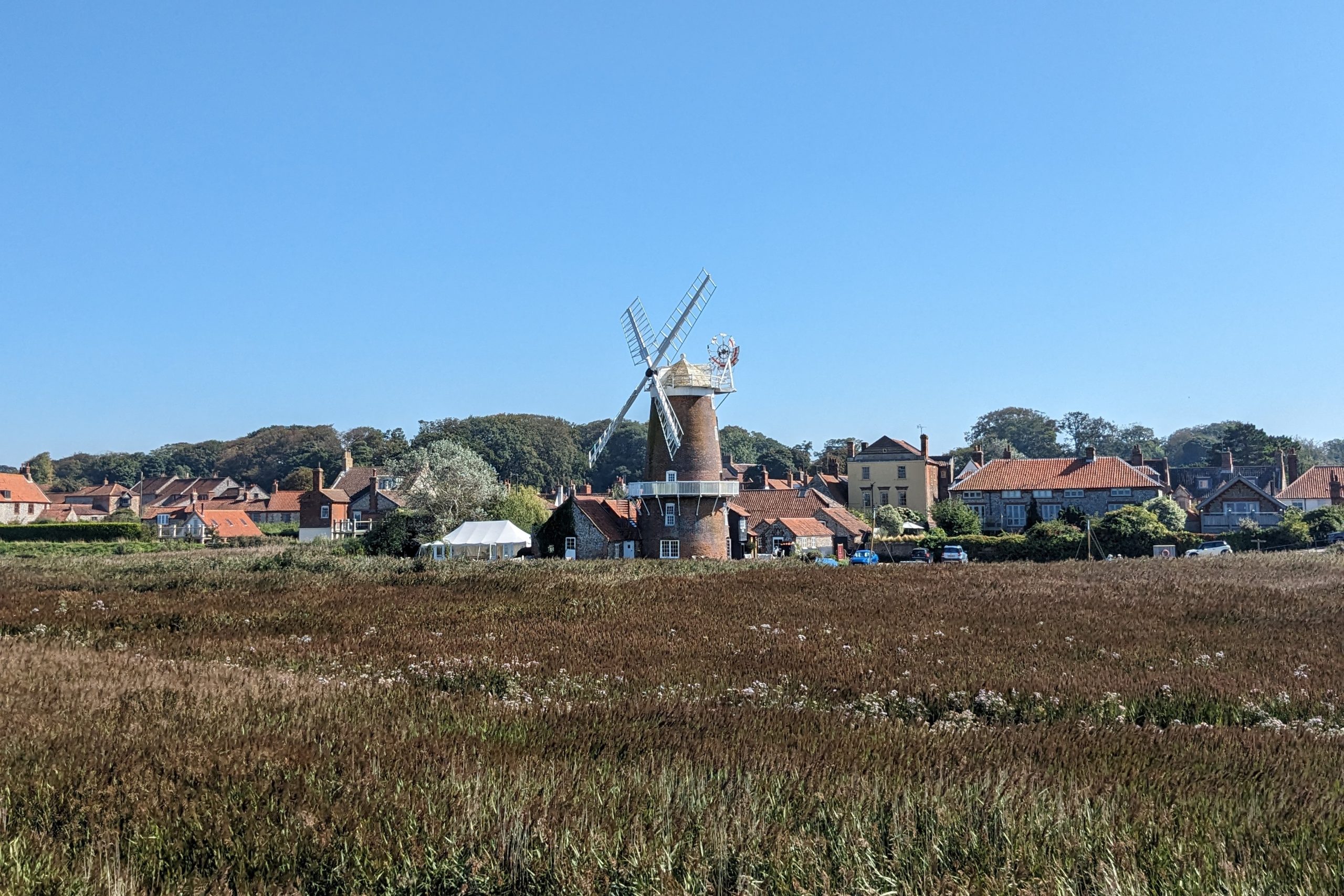
Leaving Blakeney behind, we joined the raised sea wall, curving round the salt marshes for the next two and a half miles until we reached Cley-Next-the-Sea. You can really tell when you’re approaching Cley-Next-the-Sea, as you first spot the well-known windmill in the distance. Cley-Next-the-Sea is a picturesque seaside village, with lovely little gifts shops and café, well worth a look around.
As it is not possible to secure one night’s accommodation on a weekend in Cromer, we were spending the last two nights of our trip there and using buses to get from the trail and back the next morning.
Day 5: Cley-Next-the-Sea to Cromer
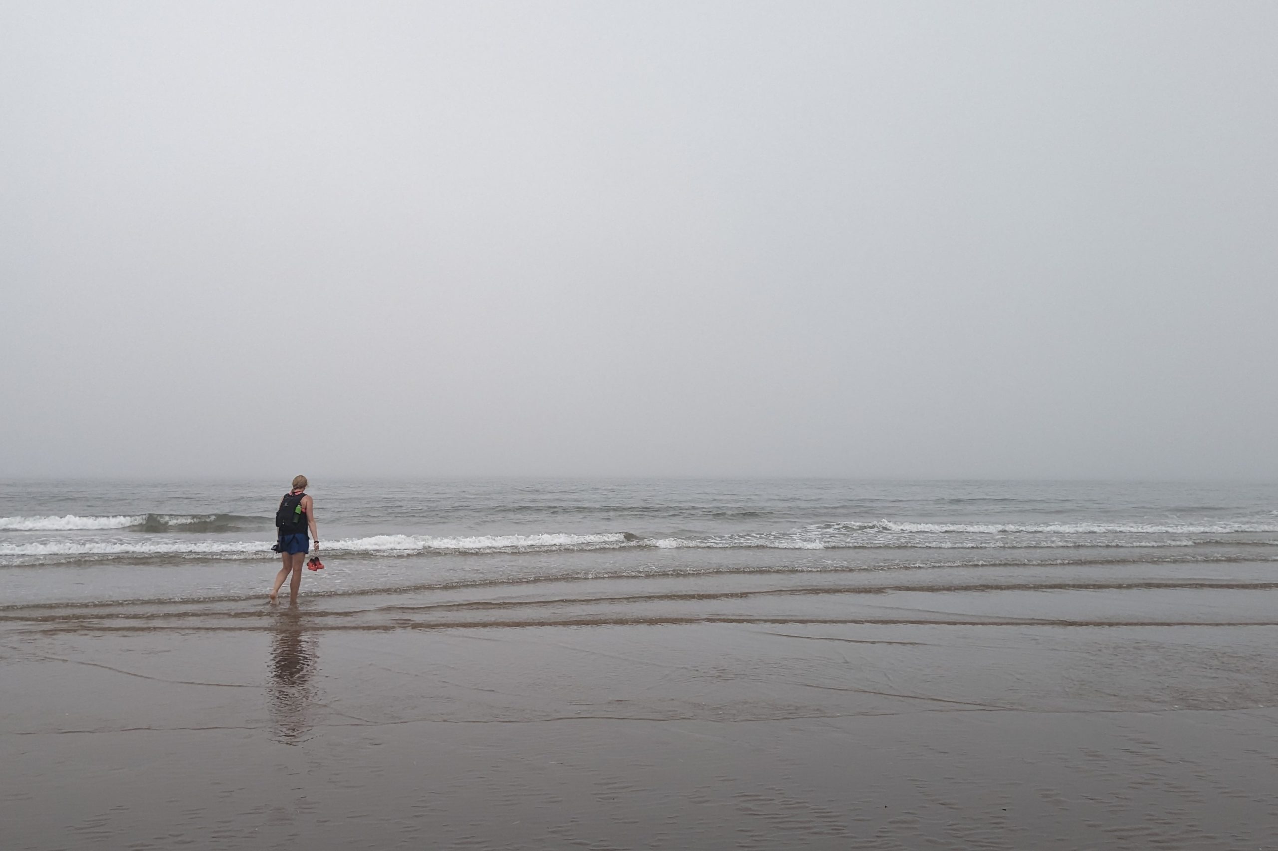
We were quite unlucky with the weather today, as it was nice and sunny when we left Cromer this morning, but by the time we arrived back in Cley-Next-the-Sea we were in thick fog with not much of a view.
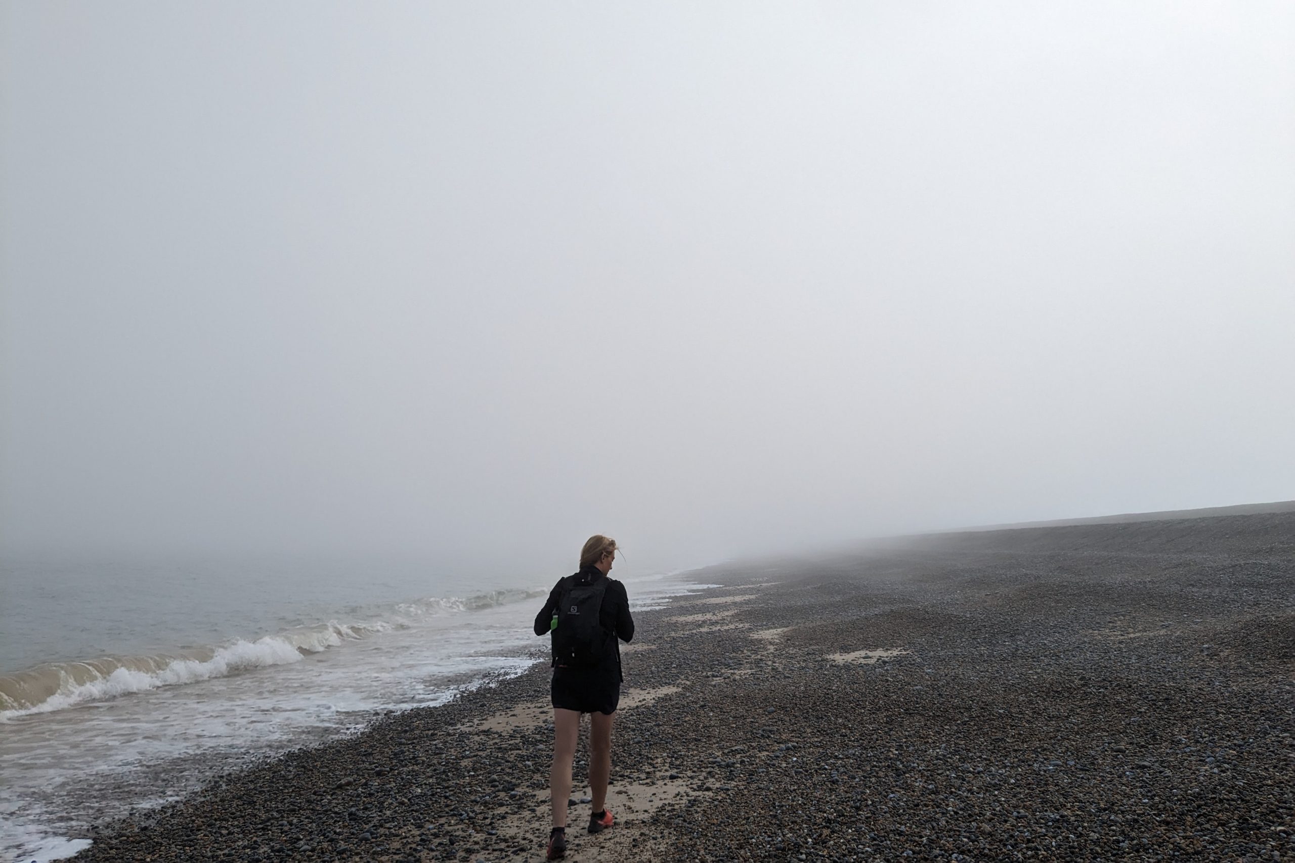
The first section of today’s walk was on a 4 mile long shingle beach which can be quite hard going. As walking on shingles is difficult, I would definitely recommend walking as close to the sea as possible, as during low tide the closest part of the beach to the sea is a mixture of sand and shingles, which makes the walk a little bit easier. We were quite lucky with tide times, as we managed to walk mostly on sand with occasional patches of shingles. This section of the walk is quite a popular fishing spot, as we saw a few anglers here hoping to catch mackerel and other fish.
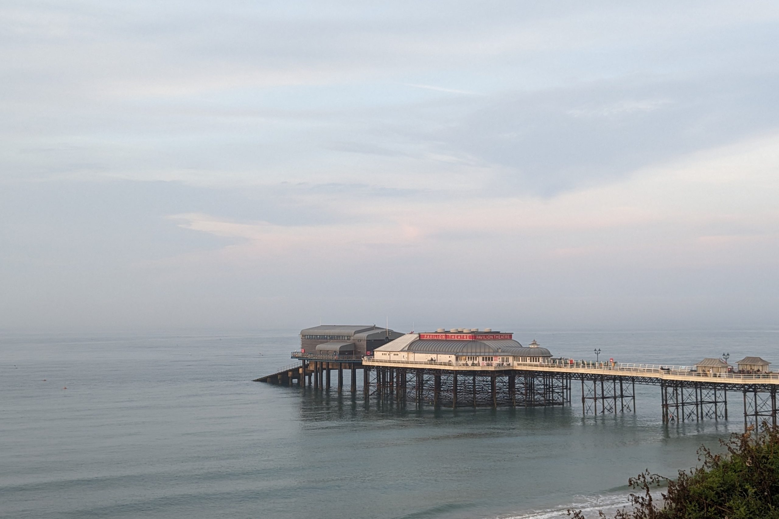
After a slow first section of the walk, we reached Weybourne Hope where shingle beach finally gave way to cliffs. The path then climbed up onto the Shelding Hill from where you supposedly get amazing views out to the sea. Unfortunately, as we were not blessed with the weather today, we couldn’t really see much more that few meters in front of us. The path then descends into the promenade in Sherington. Here, we followed the promenade above the beach, where we ended up stopping for lunch, before continuing past the town and colourful beach huts before climbing up onto Beeston Hill, which is the highest point along the Norfolk Coast Path at a mere 63m/207ft offering (supposedly) spectacular views to the sea and surrounding villages. The path then descended onto a grassy cliff tops, passing numerous caravan parks before finally reaching Cromer, the official end of our Norfolk adventure.
Overall, the weather had been so kind to us most of the week, although we had a couple of days with not so great visibility, it stayed warm and dry which is the main thing. The trail itself was very quiet, we hardly saw anybody, just few dog walkers and only when we were getting closer to villages and towns. It’s probably the easiest of the National Trails, so may appeal to anybody looking to do an easy and straightforward walk that doesn’t require much navigation skills. If you have any questions about the Norfolk Coast Path then please go get in touch as I would be happy to help, email us [email protected] or call 017687 72335.